
Invasive aquatic vegetation (IAV) is widespread in the Sacramento-San Joaquin Delta (Delta) and its change in coverage is currently mapped at the species level using spectroscopy data collected once a year. The recent launch of Sentinel-1 and Sentinel-2 may allow researchers to fill in temporal gaps and improve understanding of plant dynamics throughout the year. The study is developing methods, algorithms, and an effective workflow for monitoring aquatic and marsh plant communities year-round for decades to come. Products being developed include plant community maps and associated phenology as well as floodplain innundation to quantify the Delta Plan performance measure intended to restore more natural functional flow patterns.
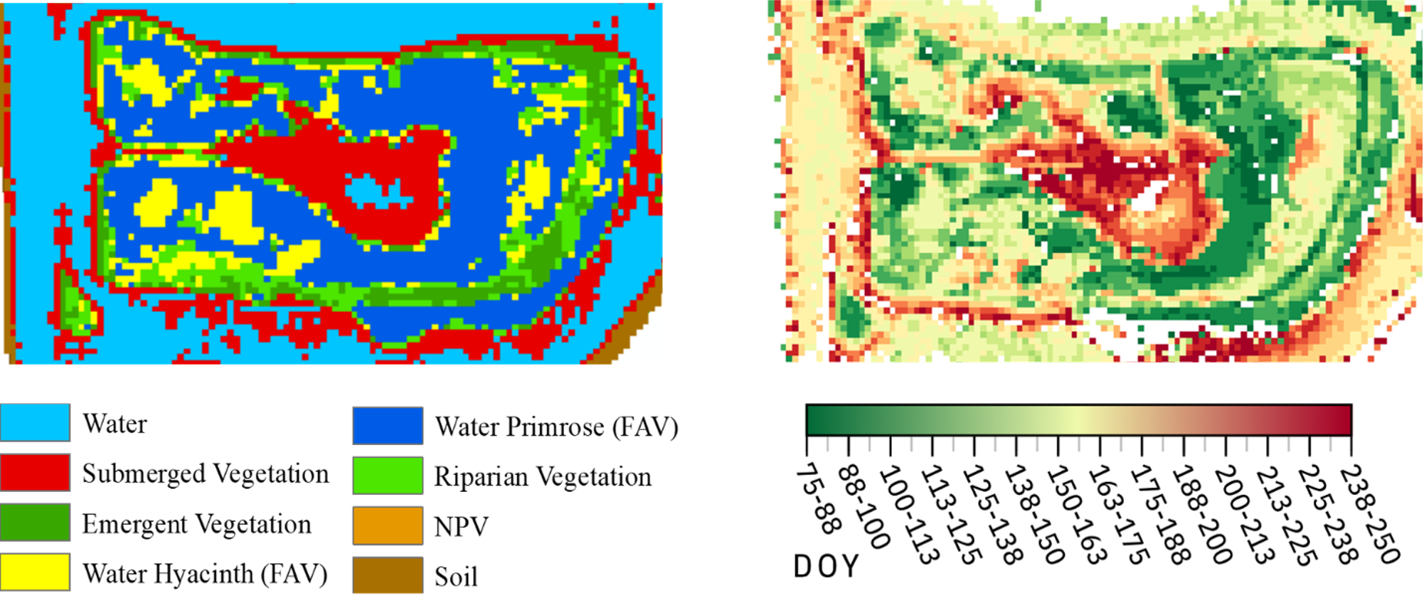
Rhode Island classification map (left) and extracted start date (right) for 2018 in Julian days from NDVI timeseries.


